Overview
Within Radar, users can input a postcode for the system to calculate the distance from for every UK address. A user can then select contacts based on their distance in miles from that postcode.
The below guide takes you through adding a new postcode and making a new selection based off an existing campaign template.
Adding a new postcode
The calculation for new postcodes happens overnight and it quite resource intensive, so it’s best to only add one postcode per day if possible.
- Login to Radar.
- Hover over the Admin option on the navbar and select ‘Data Source Editor’
- Choose Postcodes for Customer Proximity Calculations from the list
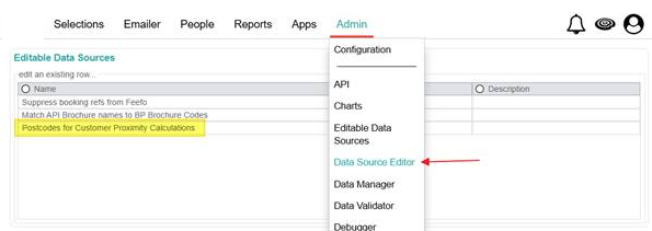
- To add a new postcode, click the ...or add a new one button
- Type in the postcode and click save
Create a new selection
A newly entered postcode will be available for selecting the following day.
- Hover over the Selections option on the navbar and select ‘Campaign’
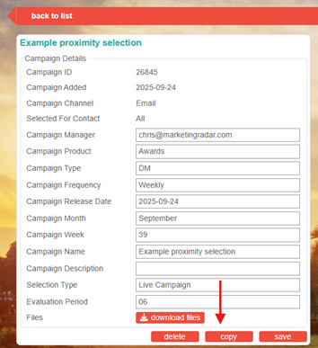
- Find and click on the campaign named Example proximity selection
- Click the ‘copy’ button and select the ‘…criteria and save page details option’
- Scroll down the page to find the ‘Distance from Postcodes’ group on the left-hand side
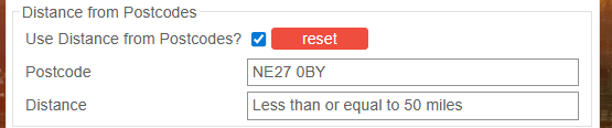
- Click the postcode box and update accordingly.
- Once complete:
- press the ‘save as campaign’ button
- Update the campaign name
- Scroll to the bottom of the page and click ‘save’
Was this article helpful?
That’s Great!
Thank you for your feedback
Sorry! We couldn't be helpful
Thank you for your feedback
Feedback sent
We appreciate your effort and will try to fix the article